
Sea Surface Temperature & Tidal Stream MapSea Surface Temperature & Tidal Stream MapUnderstanding local tidal streams and sea surface temperatures matters when planning a passage out of Par Harbour and along the south Cornwall coast. This page combines satellite sea surface temperature with a tidal stream (current) atlas covering Falmouth to Plymouth. Tidal currents around the Cornish coastline vary significantly with the state of the tide, local headlands and coastal features, so checking the direction and strength of the flow makes for better passage planning. Note that the atlas is a passage-scale product — it carries no data for St Austell Bay, Falmouth Bay, the Fal or the Tamar, so use your chart and local knowledge inshore. Monitoring sea temperature also helps with cold-water shock awareness, which remains a real risk well into the season.
Loading tidal stream data . . .
Sea Surface Temperature — Cornwall (Fri 14 Aug 2026)
Your position stays in your browser — it isn't sent to us or stored.
0°C
8°C
16°C
24°C
32°C+
Sea surface temperature for 2026-08-14 — colour scale above shows NASA's actual GHRSST palette (purple = coldest, through blue/cyan/green around the mid-teens °C, to yellow/orange/red from the mid-20s°C up). Hover over the sea on the map for an approximate reading at the cursor (read from the displayed colour, so it's most accurate away from the coastline and at normal zoom). Satellite data: NASA GIBS / GHRSST MUR (JPL PO.DAAC). Not quality-controlled; land areas are not covered. Updated 1 hr ago Tidal Stream Map (Sun 16 Aug 2026)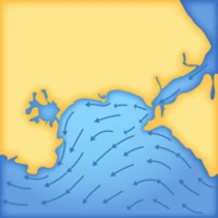
Falmouth to Plymouth tidal stream (current) atlas — 15-minute frames from High Water −6 hours to High Water +6 hours relative to High Water Par, interpolated for today's spring/neap range. (The streams themselves are timed to High Water Devonport — see below.)
High Water Par today: 8:57 am
· Range: 4.67 m (15.32 ft)
Your position stays in your browser — it isn't sent to us or stored.
Stream speed — slow
fast
0 kn
0.5 kn
1 kn
1.5 kn
2+ kn
Passage-scale product only — not for inshore/harbour navigation in Falmouth Bay, St Austell Bay, the Fal, or the Tamar (no reliable data there, so no arrows show in those areas). Generated using E.U. Copernicus Marine Service Information — https://doi.org/10.48670/moi-00054 Updated 1 hr ago |