 Web CamSt Austell Bay Boat Club has installed a webcam at the harbour offering views of St Austell Bay and the harbour. Par Beach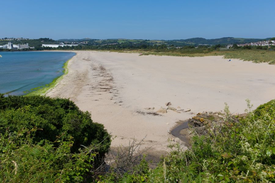 A south facing expanse of sand that could have been the jewel in the Cornish Riviera but as a result of centuries of mineral extraction above St.Austell is now a flat beach of fine silt with a backdrop of the adjacent Par Docks and China Clay Works. However, backed by a sand dune system it has some qualities including part of the dunes being a Local nature Reserve; it is Council owned and never gets overcrowded. it is a very large beach with the strip of fine white sand above high water mark that stretches from the mouth of the Par River, next to Par Docks in the west to the low cliffs at Polmear (some 900m). The easterly side of the beach with the low cliffs and stream that crosses the beach is the most popular part of the beach and the most sheltered and secluded. At low water the tide recedes for over 800m, often to Killyvarder Rocks and beyond the breakwater which runs out to sea next to the Par River. Booley Beach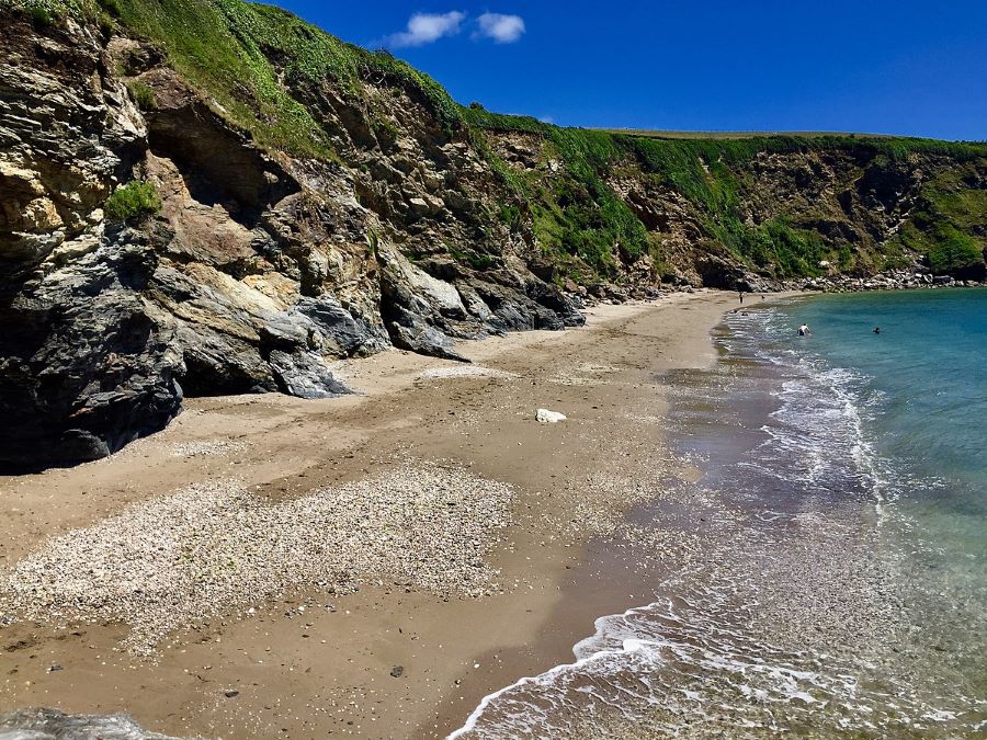 A medium sized westerly facing beach that is often joined to Par Sands at low spring tides but is completely different in character. It is reached either from Par or Polkerris along the Coast Path and is quite accessible despite being backed by high cliffs. There is little or no beach at high water but the gently sloping foreshore ends up as a mostly flat sandy beach at low water that has flat rocky ledges on its northerly side and can have patches of shingle and stone after winter storms. It is relatively exposed to winds from the west but otherwise can be quite sheltered. The cliffs on the southerly side of the beach have had a number of cliff falls in recent times. It is a quiet beach that never gets crowded. Polkerris Beach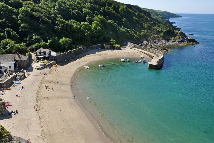 A charming hamlet and harbour overlooking St.Austell Bay with a crescent shaped sandy beach. A former fishing harbour known for its pilchards, it is now a water sports centre: its name means ‘fortified pool’. At mean high water there is a narrow strip of sand almost 100m long but when the tide recedes to he mouth of the harbour a wonderful beach appears. The other side of the harbour it is rocky but there are patches of sand at low water. Even if there is a westerly wind it is a very secluded beach especially in the lee of the harbour wall. Killyvarder Rock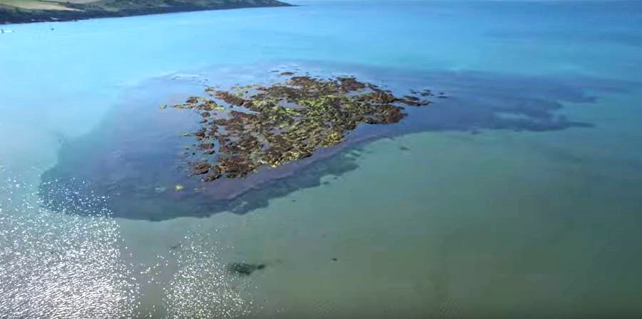 Killyvarder Rock, is a small rocky island that is fully submerged at height tide. There is a Marker Pole on the seaward edge to help people identify its location. Gribbin Head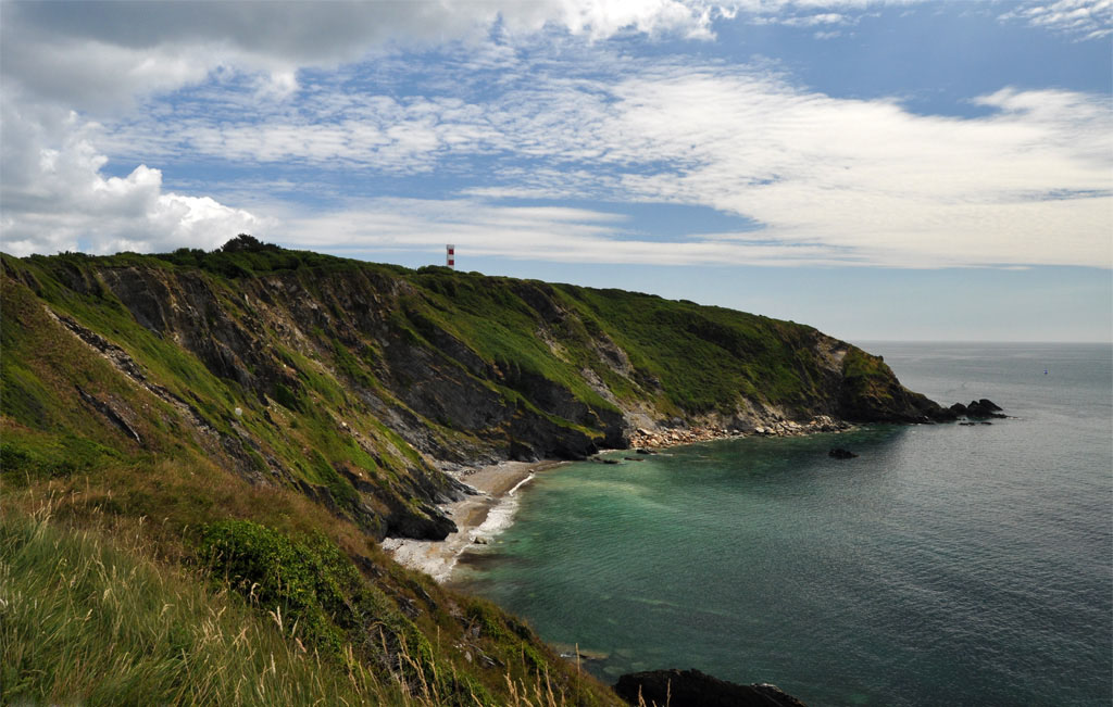 Gribbin Head is a promontory on the south coast of Cornwall, England, UK, owned and managed by the National Trust. It separates St Austell Bay from the estuary of the River Fowey and is marked by a large tower used to aid navigation of ships approaching the local harbours. The nearest town is Fowey. The western point of the headland is called Little Gribbin. Gribbin Head is the most southerly part of the parish of Fowey. To the north, and facing west across St Austell Bay is the small village of Polkerris, beyond which is the harbour at Par. To the east is Polridmouth cove and the Fowey estuary, where the town of Fowey itself is situated. Inland, to the north, is the Menabilly estate, built for the Rashleigh family but later home to author Daphne du Maurier. The 75 metres (246 ft) high[5] promontory forms a part of the South Coast (eastern) section of the Cornwall Area of Outstanding Natural Beauty. The South West Coast Path passes around Gribbin Head on its way from Minehead in Somerset to Poole in Dorset. Westcountry Mussel Farm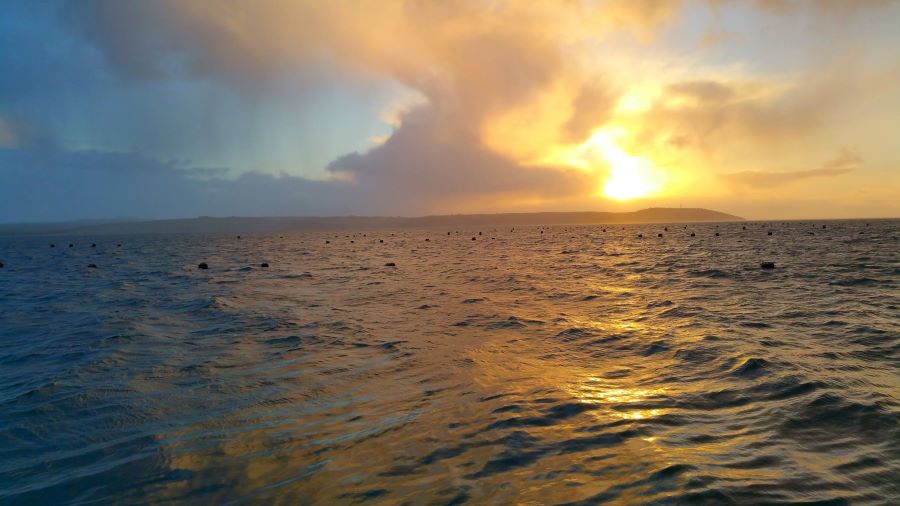 Westcountry Mussels of Fowey Limited is based in Fowey, Cornwall, and is the original “Fowey” Mussel. We specialise in offshore mussels and, weather dependent, we will be out at sea harvesting mussels every day, all year round. Gwineas Rock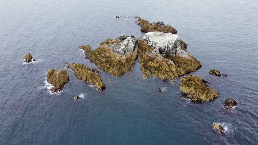 The Gwineas, also known as The Gwinges, are a set of approximately fifteen rocks in the extreme southern English Channel, off the coast of the fishing village of Gorran Haven, Cornwall, United Kingdom, remarkable for its seals, dolphins, gannets, and cormorants.There is not too much known about the Gwineas. Like other notable rocks around the Cornish coast, the Gwineas is always locally referred to as 'Gull Rock'. This may also be reflected in the name, if it has been made up from the Cornish words meaning 'white' and 'island'. Chapel Point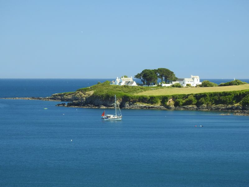 There is a quiet mystery about Chapel Point in Portmellon. It is located in an exposed spot, but in a stunning location. There are three private houses built in the 1930s by Scottish architect John Campbell. The fascinating history about these houses can be found in a Daily Telegraph article: Property in Cornwall: revamp for a 1930s architectural gem.This history includes the unfortunate death of the architect in a fall on nearby cliffs. It is an amazing spot and quite unlike anywhere else on the Cornish coastline. Located in South Cornwall, and being in such a dramatic location, Chapel Point makes an appearance in a Daphne Du Maurier novel, this time “The House on the Strand”. Black Head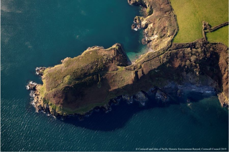 Black Head is an ancient promontory fort near St Austell in Cornwall, England.Promontory forts are a type of hillfort which make good use of natural defenses such as high cliffs. In this site the defenses have been improved by the construction of a series of ramparts placed across the neck of a spur in order to divide it from the surrounding land. You can see the ditches at the bottom of the aerial plan view on this page. There appear to be at least three banks and ditches across the spur at Blackhead. The ramparts and accompanying ditches formed the main artificial defence, but timber palisades may have been erected along the cliff edges. Access to the interior was via an entrance through the ramparts. Par Harbour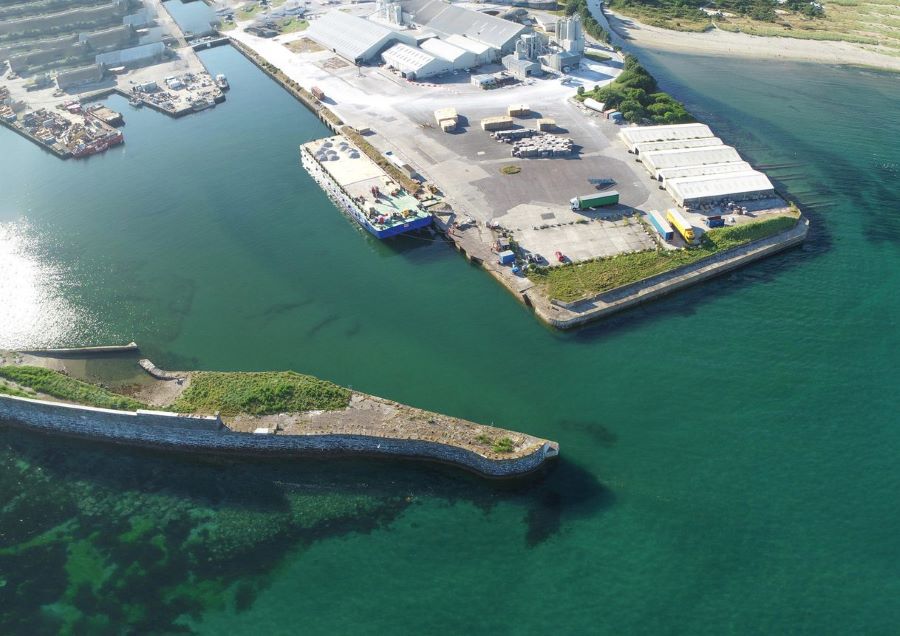 The Harbour with The Cornish Alps (Clay Spoil Tips) on the skyline above St Austell. Par Harbour was built (1829/1840) by a local entrepreneur J T Treffry who wanted to export Copper from his mine.Cornish granite was also exported in the early days for such famous landmarks as Waterloo Bridge,Chatham, Gibraltar and Glasgow Docks. China clay is piped to the harbour in slurry form, dried in large sheds before transportation by Private Road (the former rail line) to Fowey. |
|
© SABBC 2026
[Cookies]
[Privacy Policy]
|